
Accurate existing-building data, from day one.
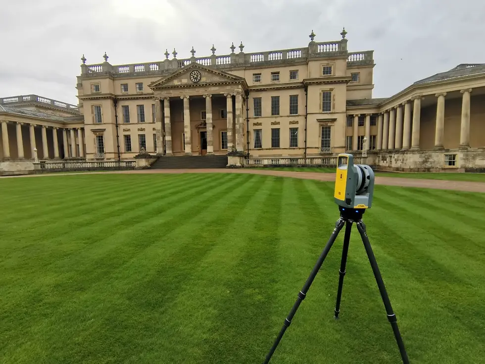
We deliver measured building surveys throughout Cheltenham, an elegant Regency spa town on the edge of the Cotswolds. Using high-definition laser scanning and total stations, we record the exact dimensions, layout and features of a building and produce accurate 2D plans and 3D models for architects, designers and contractors.
From renovations and extensions to conversions and refurbishments, our Cheltenham measured building surveys give a reliable record of what is really there, which matters particularly given Cheltenham's Regency architecture, listed frontages and sloping Cotswold-edge sites.
Floor Plans
Heritage Measured Survey
Building Elevations
Roof Plans
Internal Measured Survey

WHAT'S INCLUDED IN YOUR MEASURED BUILDING SURVEY
What We Deliver
A measured building survey starts with the floor plan. Our surveyors capture every structural detail of your building, including walls, door and window positions, ceiling heights, fixtures and fittings including electrical points, light switches, sanitary ware and furniture positions.
The result is a set of accurate, scaled drawings that architects, interior designers and contractors can work from directly. Whether you are planning a domestic extension, a commercial refit or a change of use, our floor plans give your project team the reliable data they need.
Elevations capture the vertical face of a building, inside and out. Our elevation surveys document facade details, window and door arrangements, external features and internal wall profiles with the same precision as our floor plans.
Using 3D laser scanning technology, we can capture elevation data quickly and to a very high degree of accuracy, even on complex or historic structures where traditional measurement would be time-consuming or impractical.
A roof plan captures the geometry and structure of a building's roof from above, including ridges, hips, valleys, drainage points and any roof-level features. This is essential for planning applications, extensions and maintenance projects where accurate roof dimensions are needed.
We produce roof plans as standalone deliverables or as part of a full measured building survey, depending on your project requirements.
All of our survey data can be delivered as clean, professional 2D CAD drawings ready for use by architects, designers and contractors. Drawings are produced to an agreed scale and level of detail, and can be provided in DWG or PDF format.
Whether you need floor plans, elevations, sections or roof plans, our CAD output is accurate, clearly annotated and ready to work from.
Where a project requires more than flat drawings, we can produce fully rendered 3D models from our survey data. These give a dimensional representation of the building that is useful for design development, visualisation, clash detection and BIM workflows.
3D models can be delivered in a range of formats depending on your software requirements. Get in touch to discuss what works best for your team.
An as-built survey records a building as it actually exists, rather than as it was originally designed. This is used to verify that construction matches approved drawings, or to create an accurate record of a structure for future design, maintenance or compliance purposes.
Our as-built surveys combine measured data capture with precise CAD output, giving you a reliable record you can rely on throughout the building's lifecycle.
For projects that demand the highest level of accuracy, or where a building presents complex geometry, our 3D laser scanning service captures millions of data points in a single survey visit. The resulting point cloud gives a complete, measurable digital record of the building as it exists.
From that point cloud we can produce 2D CAD drawings, 3D models, or BIM-ready outputs depending on what your project requires. It is a faster and more accurate way of surveying than traditional methods, and significantly reduces the need for return visits.


— WHY CHOOSE GEOSHAPE
Operating across Cheltenham and Gloucestershire
We cover Cheltenham and the surrounding areas, including Montpellier, Pittville, Charlton Kings, Leckhampton and Prestbury, as well as the wider GL postcode area and neighbouring towns such as Gloucester, Tewkesbury, Bishop's Cleeve and the Cotswolds. Our regional coverage across Gloucestershire means fast mobilisation and first-hand knowledge of local sites.
Frequently Asked Questions
A measured building survey is a precise record of an existing building, produced to scale. It captures the dimensions, layout and structural features of a property and is used as the basis for design, renovation, planning and construction work. Outputs typically include floor plans, elevations and sections.
3D laser scanning uses a high-definition scanner to capture millions of precise measurements of a building in a single visit. The data is processed into a point cloud, which can then be used to produce 2D drawings, 3D models or BIM outputs. It is faster and more accurate than traditional survey methods, particularly for complex structures.
A 2D plan is a scaled drawing showing the building from above or in elevation, used for design and planning purposes. A 3D model creates a dimensional representation of the building, useful for visualisation, design coordination and BIM workflows. We can provide either or both depending on your project needs.
Scan to BIM is the process of converting 3D laser scan data into a Building Information Model. It captures the as-built condition of a structure and translates it into a BIM-ready file, giving design teams accurate existing conditions data to work from.
We cover Bristol, Cardiff, Bath, Newport, Swansea and the wider South West and South Wales region. Contact us to confirm coverage for your specific location.
This depends on the size and complexity of the building. A straightforward domestic property might be completed in a few hours, while a large commercial building could take a full day or more. We will give you a clear timeline when we discuss your project.


